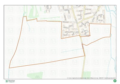
- 106.5ha
- 800 homes to 2037 (450 after)
- From 2026-2027
Policy 27 of the Local Plan identifies that the following infrastructure and services should be provided through the new development:
Housing
- 25% of homes will be for affordable housing, 25% of these will be First Homes for first time buyers
- All market housing should be designed as accessible housing for older people
- Sheltered housing for older people
- Extra care accommodation
- 5% of homes will be designed for wheelchair use
- 10% of homes should for self-build and custom build housing
Green/blue infrastructure
- 23ha country park
- 4ha of open space; to include children and young peoples’ facilities, amenity space and allotments
- 10% biodiversity net gain
- 5 new trees per home
- Landscape buffer around the boundary of the site
- A flood management scheme including sustainable drainage and de-culverting the drainage channel on the western boundary
Social and community facilities
- 5ha of land for a 1 form entry primary school and early years facility on site. Ordsall South will provide a financial contribution to enable delivery
- A Local Centre, including a convenience goods store on site
- A health hub on site including space for a doctor’s surgery and community health facilities and a financial contribution towards improving Bassetlaw Hospital
- A community centre and sports facilities on site
- A financial contribution to improve the quality of Retford golf course
Transport infrastructure
- A two-point distributor standard access to the east and west parts of the site
- High quality, safe and direct walking, cycling and public transport routes within the site
- Highways demand management measures
- New walking and cycling links including:
- A new footpath and marked cycle path along the Ollerton Road frontage
- Pedestrian and cycle links from the site to neighbouring areas to the north, including a financial contribution towards a marked cycle lane along Brecks Road from West Hill Road
- Improvements to the public rights of way network on site and along its boundaries
- Financial contribution towards pedestrian and cycle links from the site to Old Ordsall Village
- Financial contribution towards a high frequency bus service from the site to Retford and the town centre and new bus stops across the site
- Financial contribution to improve:
- A620 Babworth Road / B6420 Mansfield Road / A620 Straight Mile / Sutton Lane junction
- Ordsall Road/A620 Babworth Road junction
- London Road / Whinney Moor Lane / Bracken Lane junction
- London Road / Whitehouses Road junction
- provision of traffic calming schemes along Main Road, Eaton and at Ordsall Old Village
Masterplanning
- The site promoters should agree a masterplan framework with the Council – this should be after consultation with the local community. This should include:
- A delivery strategy and a phasing plan; including the number and phasing of homes and the infrastructure to be provided for each phase

Last Updated on Monday, December 16, 2024