Contents
- Introduction to the Vision
- The Baseline
- Historic Development and Context
- Make the Most of the Opportunity
- Sustainability, Health and Wellbeing - Guiding Principles
- Public Spaces - Healthy, Active and Inclusive
- Movement, Transport and Parking
- Key Sites and Land Use
- Design and Appearance
- Conclusion and Next Steps
- Appendix 1: Opportunity Site Planning and Development Brief
- Appendix 2: Former North Borders School Planning and Development Brief
- Feedback
Introduction to the Vision
This document outlines the vision and ambition for Harworth and Bircotes Town Centre for the next 20 years and includes a series of projects to deliver this in the short, medium, and long term. The Masterplan has been funded by the South Yorkshire Mayoral Combined Authority and commissioned by Bassetlaw District Council and Harworth and Bircotes Town Council. The Masterplan is intended to be a framework for investment and action and includes a series of measures and projects that will improve the physical environment, attract appropriate forms of development, and create the conditions for community cohesion and local prosperity.
This Masterplan has been developed following community engagement in September 2021 where views were sought on the both the need for change and some initial ideas. These ideas have been refined and changed in response to community views and suggestions including:
- Plans to make Scrooby Road into a one-way system eastbound have been abandoned in this Masterplan
- A greater emphasis on the Town Centre as a leisure destination
- Improved connectivity between new and existing housing areas to and through the Town Centre
- Better access and improvements to existing greenspaces for people and nature
- Local food production, allotments, and social enterprise activities to support these and alleviate food poverty
- Renewable energy and electric vehicle charging centre in the Town Centre
Local Members have contributed to the development of the Draft Masterplan and thanks are expressed to all who have contributed their ideas and local knowledge to the process.
Image: Scrooby Road local shops and services

Image: Scrooby Road Streetscape
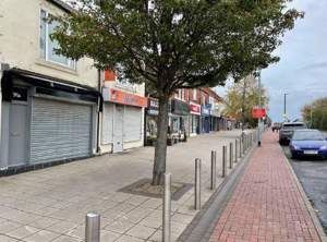
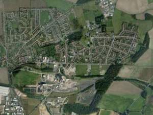
Image: The Masterplan Area within the Town Centre

The Vision for Harworth and Bircotes
“By 2030 Harworth and Bircotes Town Centre will support the daily needs of the expanding population, providing a wide range of shops, housing options, services and leisure opportunities. Through the delivery of a consistent and ambitious vision and with the careful management of the Town Centre, economic growth and community wellbeing will be supported.”
Note: The Masterplan boundary and the town centre boundary identified in the Draft Bassetlaw Local Plan are different. The Masterplan recognises the need for investment in areas outside, but with strong physical and visual links to the Local Plan boundary to facilitate better connectivity and a range of uses that will support the shops, leisure and services within the Local Plan boundary.
The Baseline
Town Centres and high streets are in a state of flux because of changes in shopping patterns, transport and mobility, the internet, and the loss of some nationally recognised chains, particularly in the retail sector. Harworth and Bircotes Town Centre is no different to many insofar as the mix of uses has changed in recent years. Additionally, the recent pandemic has highlighted health inequalities and the importance of local shops and services within reach of the neighbourhoods that they serve.
The Bassetlaw Local Plan identifies Harworth and Bircotes as a Main Town. The most recent Retail and Leisure Study (2017) identifies Harworth and Bircotes in the top four retail centres in the District. The town also benefits from a made Neighbourhood Plan (2015). The Retail and Leisure Study identifies Retail Services, such as hairdressing and beauty as being the dominant use followed by Leisure Services including takeaways and restaurants. Comparison retail (non-food) is lower than the UK average with a strong convenience retail offer in the form of freezer shops and two major supermarkets, that also sell a wide range of goods and provide some services such as pharmacy. This data is comparable to the Council’s annual monitoring of Harworth and Bircotes Town Centre in terms of patterns and trends.
Other findings include:
- The vacancy rate is about typical for this type of town centre
- The townscape and streetscape are considered average in quality
- Perceptions of safety are good, with concerns over a lack of diversity after 5PM in terms of uses and footfall
- Most people arrive by car, although recent public engagement suggests that patterns are changing
| Nexus Retail Survey, June 2016 | # | % | % |
|---|---|---|---|
| Convenience | 8 | 13.6% | 8.6% |
| Comparison | 11 | 18.6% | 32.0% |
| Retail Service | 17 | 28.8% | 13.9% |
| Leisure Services | 15 | 25.4% | 23.4% |
| Financial and Business Support | 3 | 5.1% | 10.6% |
| Vacant | 4 | 6.8% | 11.2% |
| Other | 1 | 1.7% | 0.1% |
| Total | 59 |
Vacancy Rates in Harworth and Bircotes
Footfall appears to be greatest in the eastern half of the town centre with a notable drop-off to the west, where the uses change, and the continuity of the frontage is more sporadic. The findings of the Retail and Leisure Study are in line with annual monitoring of the town centre, observations made over several site visits and provide a useful starting point for the Masterplan.
The Bassetlaw Local Plan 2020-2038 identifies that Harworth and Bircotes will effectively double in size within the life of the Plan due to a number of sites within the town having planning permission for housing, including the former Harworth Colliery site. As such is an attractive location for investment in retail and leisure in the future and the Plan identifies the Town Centre will require modest growth under Policy ST14. With a population nearing 8000 people Harworth and Bircotes is an ideal size to attract a more diverse retail offer and to be able to support community led initiatives and cultural life.
Image: Extract from the Local Plan Publication Draft (2021) with the proposed extension to the Town Centre (HB01)

The Local Plan Policy ST13 states also for the main town centres that:
“2. The town centres will be the principal locations for major retail, leisure, entertainment, cultural facilities and community services over the plan period.
"3. Temporary uses in vacant premises as well as residential development will be supported, where the proposal does not impact on the vitality and viability of the centre and where it does not cause unacceptable impacts for neighbouring uses or compromise current or planned/ committed future use.”
The recent public engagement in September 2021 revealed some additional findings alongside some anecdotal evidence that there needs to be a more diverse housing mix in the area to provide for older people and younger people just starting out, the complement the family housing that is currently being delivered. Additionally, a desire for more leisure uses has been identified, alongside an improved evening economy and family friendly activities and facilities within the Town Centre, which is within walking distance of an increasing population.
The new Market Square and events space is gaining popularity and the connectivity to Simpson Park is another example of the wider ambition for an accessible Town Centre, delivered in part by the “Harworth Wheel” concept of circular and connecting routes around and into the centre of Harworth and Bircotes.
Image: Market Day in Harworth and Bircotes
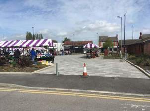
Image: Harworth Wheel
Historic Development and Context
Harworth & Bircotes became a town in 2010. The name Harworth is Saxon in origin and means “farm on the boundary”. The Doomsday Book informs that the parish is substantially a woodland area but it did have a Saxon Church dedicated to “All Saints” and was built on a mound.
Indications are that Church needed to be rebuilt in the 12th Century and throughout the Middle Ages Harworth slowly developed into a large farming community. During 1700 -1705 a free school was built in Harworth funded by Robert Brailsford, who was the cook at Serlby Hall. The school gave free education to 4 boys and 20 girls. Each village had an annual feast day and it is understood that Harworth was designated the 1st November.
The late 19th century saw the area prosper as more homes were built, and Viscount Galway became an important employer for the area. He employed not only staff for Serlby Hall but tradesmen such as butchers, blacksmiths, wheelwrights, and publicans to serve the local farming community.
During the early part of the 20th Century fuel was essential for growing number of factories that emerged. It was in this era that coal was needed more than ever before. This would change not only the landscape but bring much needed employment to the area.
The original shafts at Harworth Colliery started in 1914 by a German Company but owing to World War 1 this work ceased. In 1917 Barber & Walker bought the rights to the mine and 350 acres of land that was to be used for housing for the miners. This was the birth of Bircotes. The place name of Bircotes is Anglo Saxon in origin meaning “small dwelling".
Source: Harworth and Bircotes Town Council.
Image: Harworth and Scrooby Road around 1885
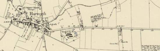
Image: Harworth and Scrooby Road around 1938
Making the Most of the Opportunity
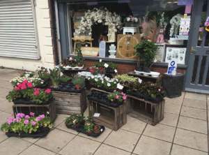
A growing settlement within Bassetlaw District Harworth and Bircotes is an area of significant regeneration following the final closure of the colliery and subsequent demolition in 2016. There are several high-quality shops and cafés along Scrooby Road and the new Market Square has provided a new attraction and a new confident image for the local area.
Image: Attractive retail display on Scrooby Road
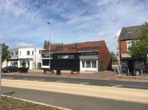
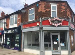
The Town Centre has some key characteristics that form the basis for future interventions. Architecturally there is an identifiable early Twentieth Century style to some of the best of the buildings and these add value to the street scene and could set the tone for future building designs.
Images: Harworth and Bircotes Storefronts
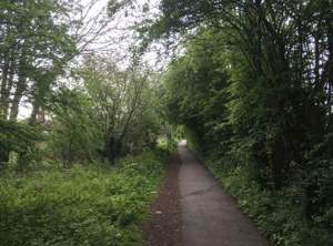
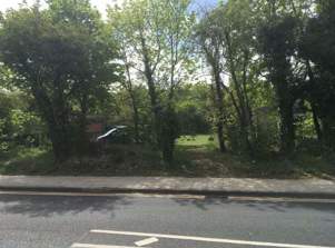
The presence of the natural world is an important characteristic that presents an opportunity for a healthy and green future. There are local wildlife sites close to the Town Centre and great connections to the countryside that can be improved.
Image: Connecting route to the Town Centre
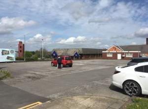
The west of the Town Centre has several sites that are on the edge that are set back from the street, reducing the enclosure and sense of place and these provide an opportunity to consolidate the offer in the future.
Image: Car parks dominating the street scene
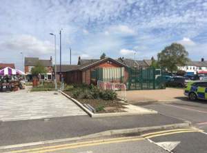
The Town Centre on the southern side of Scrooby Road is dominated in the centre by the Town Hall and Police Station. These important uses could be accommodated elsewhere in the Town Centre freeing up space for a different range of uses associated with the Market Square and rationalising the publicly owned buildings.
Image: New Market Square and rear of the Police Station
Sustainability, Health and Wellbeing - Guiding Principles
Sustainability is a core principle within the Masterplan. Climate change mitigation using energy efficiency measures, renewable and low carbon technologies, and reductions in trip demand for motorised transport are key objectives that underpin the vision and actions associated with the Masterplan. Public engagement has revealed a local desire to tackle climate change and create greater wealth within the community through reduced energy consumption and participating in the energy market.
In addition to this climate risks such as extreme weather events, surface water management and summer overheating are key considerations and have been included in the proposed measures ensuring that the Town Centre is a great place to be and sets the tone for the future of Harworth and Bircotes.
Allied to the challenges of climate change there is a recognition of the importance of nature and the need to provide additional habitats to support biodiversity net gain. Creating additional space for nature whilst also proving existing assets has been woven into the proposed actions to deliver the Masterplan and underpinned the spatial concepts.
Harworth and Bircotes is within the top 30% of places with high indices of multiple deprivation, with significant challenges in terms of health and wellbeing. There are a greater than average number of people living with long term conditions or a disability (around 25%) and the incidence of respiratory illness remains high.
To meet the needs of an ageing population and to support the needs of those with long-term health conditions the Masterplan has been developed to ensure access for all to the town centre and also to find opportunities to integrate greenspace, local food production and physical activity into the proposed interventions.
In terms of wider determinants of health there is significant income deprivation at around 17% and child poverty is also high in comparison to the England average. However, Harworth and Bircotes benefits from a good environmental quality and through economic growth and access to employment there is the potential through the Masterplan to improve these wider determinants. To support health and wellbeing the Masterplan will seek to:
- Improve access to and the quality of greenspaces
- Provide opportunities for local food production
- Support the provision of quality social infrastructure such as community facilities
- Improved pedestrian and cycle connectivity to, from and within the Town Centre and to key employment sites
- Promote community led planning and community ownership of key assets
- Provide facilities that support education, training, and lifelong learning
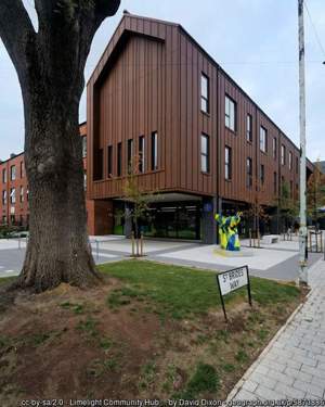
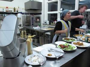
Image: Limelight, an award-winning health and wellbeing Hub in the heart of Old Trafford, Greater Manchester.
Public Spaces - Active and Inclusive
Greenspaces are important to the people of Harworth and Bircotes and the landscape in and around the town centre is substantially green in character. Whether in the form of woodland, hedges and verges, previously developed land or formal parks and recreation facilities there are opportunities to improve the access and quality of these spaces.
Image: Green spaces in and around the Town Centre.
Within the scope of the Masterplan there is scope to create new green public spaces as a part of new development, alongside improvements to streets, connecting routes and existing hard landscaped areas. All new public spaces should be multi-functional contributing to flood and water management, improved biodiversity and habitats, access, and amenity.
The Market Square is recognised as an asset to the function and appearance of the Town Centre and there are opportunities to extend the presence of this asset across Scrooby Road with the view to occasional road closures to allow for events, festivals, and specialist markets to bring the two sides of the Town Centre together.
Local food production has also been identified as being important, and opportunities exist to grow food in and around the Town Centre. There are significant numbers of allotment holders who wish to share their knowledge and skills and this expertise could assist the establishment of a local and resilient food system, including a community shop and kitchen.
To create an attractive Town Centre for all, opportunities for creative play will be promoted through new development and improvements to existing public spaces. This could include interactive lighting, ‘playable’ street furniture and sensory play.
Associated with improvements to the road network additional street trees will be provided complementing the current row on the north side of Scrooby Road.
Image: Local food production could reduce food poverty

Image: Community Kitchen (Credit: Laura Billings)
Project 6A - Market Square Extension
Combined with a raised crossing table and extending the materials' palette across Scrooby Road this extension to the Market Square will be a traffic calming measure, join the two sides of the road and increase the scope for events and specialist markets. Subject to feasibility, this could become the main central crossing point for pedestrians and cyclists and be a clear signifier of the transport hierarchy that prioritises active travel.
Funding: The project has an association with the potential redevelopment of the Town Hall and Police Station Site and could be funded in part from land receipts as part of the wider regeneration of the south of Scrooby Road.
Action Points:
- Feasibility and detailed cost design
Image: Project Concept Map
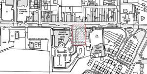
Image: Scrooby Road before
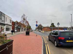
Image: Concept art of Scrooby Road after the Market Square extension

Project 6B - Land Acquisition
There are underused sites close to the Town Centre that could be used to support social enterprise, community food production and support habitats and ecology, associated with the existing green infrastructure assets, such as local wildlife sites. In public of community ownership, the future of these sites can be secured, contributing to biodiversity net gain and future proofing new development in the Town Centre by providing offsetting and strategic benefits, such as flood and water management.
Funding: Consider the use of the Community Ownership Fund (or similar) to secure strategic acquisitions.
Action Points:
- Identify key sites
- Engage with landowners
- Form a community group in readiness to operate and manage community assets
Project 6C - Play on the Way
There are several suitable locations associated with new development opportunities or in existing spaces where play can be incorporated to provide interest and experiences for people of all ages. With creativity at the heart of the interventions these could include playable features such as natural objects such as logs and boulders alongside more complex installations involving lights, sound and interactive features. This will add to the attractiveness of the Town Centre for multi-generational visits, and retain the local population for regular visits.
Funding: Projects within the wider theme could be written into briefs to be delivered as public goods alongside Section 106 payments, where appropriate.
Action Points:
- Develop a Town Centre Play Strategy with thematic and narrative content to reflect local cultural and natural heritage and create a whole visitor and resident experience.
- Identify the inaugural site for the first installation.
Project 6D - Edible Harworth and Bircotes
Learning from the experience of Incredible Edible Todmorden (IET) develop a local food growing and sharing network that takes advantage of both formal and informal food growing opportunities. Extending as far a food processing and distribution this social enterprise will form part of a wider ‘food web’ in Harworth and Bircotes, addressing local poverty and creating community resilience and cohesion. Meantime spaces will be colonised by food growing activities and new allotments will be created where possible (see also Key Sites and Land Use).
Funding: The initial stages of establishing a group is relatively inexpensive and could be the recipient of a small grant. Once constituted further funding can be sought.
Action Points:
- Organise a delegation to visit IET to learn from the experience
- Liaise with partner social enterprises to develop partnerships and share learning
- Liaise with anchor institutions (Councils, schools, Fire and Rescue, NHS etc.) to identify growing opportunities and possible links to social prescribing
Movement, Transport and Parking
Harworth and Bircotes Town Centre is dominated by Scrooby Road which is straight in character and divides the north and south of the high street. In the main parking is accommodated to the south of the Town Centre either associated with the supermarkets, Town Hall or the Primary Care Centre. Parking is free in the main and is complemented by some bay parking on the north side of Scrooby Road.
In surveys and the recent public engagement, a significant proportion of visits to the Town Centre are on foot or by bicycle, confirmed by site observations. Public transport is available with bus stops close to the Town Centre but no stops along Scrooby Road.
There are reported issues of speeding along Scrooby Road and pavement parking outside the takeaways. Overall, the public realm and streetscape is tired and poor quality in places on the southern side of Scrooby Road and on the western end. Congestion and highway safety concerns associated with school drop off and collection have formed part of the community engagement response.
The ownership of the highway is complex, with private plots extending into the public realm as illustrated in the plan adjacent.
A zebra crossing connects the north and south sides of Scrooby Road adjacent to the Primary Care Centre. To the east a signal-controlled crossing adjacent to Asda across Scrooby Road with a further crossing connecting to the housing and services on the south side of the road, including the Town Hall, GP and Police Station. Overall, despite these crossing points Scrooby Road divides the Town Centre into two halves.
Image: Privately owned paved areas
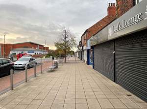
Image: Map of potential highways improvements (the highway is shaded in green)
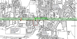
Project 7A - Future Highway Improvements
To improve the Town Centre for pedestrians and cyclists, and to future proof this to accommodate increased footfall and active travel choices investment in Scrooby Road will be required. At present there is insufficient width to accommodate segregated cycle lanes designed to the new standards required under LTN 1/20. As part of an integrated network in an around the Town Centre cycle lanes will increase the number of cyclists who can confidently visit, alongside connecting to routes outside. Much of the south of Scrooby Road is in public ownership and additional land could be released through new development to facilitate these improvements in the future.
Funding: The allocation of additional land will be incorporated into future planning and development briefs as part of the public goods to be delivered.
Action Points:
- Allow for addition pavement and cycle provision within the forthcoming brief for the Opportunity Site (HB01)
- Negotiate with the NHS regarding the remodelling of the entrance to the Primary Care Centre, releasing some of the landscaped area.
- Develop a concept design for Scrooby Road delivering public realm improvements (see Project 7B
- Bringing the High Street to Life) including bus stops close to key anchors and attractors
Project 7B - Bringing Life to the High Street
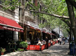
Scrooby Road has a strong linear structure, some attractive frontages and pavement cafés and retail displays are beginning to be established, making use of the available space. However, patterns of usage are disjointed and unregulated. With a south facing aspect the space in front of the buildings on Scrooby Road is ideal for further usage throughout the day and into the evening.
To regularise this situation and to stimulate activity on the street a combination of permissions, promotion and design guidance is proposed to maximise the potential of this space. Uses could include:
- Outdoor dining including windbreaks, shelter, and heating
- Retail display and seasonal sales space
- Complementary activities and promotions associated with specialist markets
- Relaxation and breakout space
- Community food growing sponsored by the host business
- Beer gardens
Funding:The investment required for physical infrastructure (boundaries, power, shelter temporary surfaces) will be the responsibility of the business operator with the potential for a grant funding package if resources can be identified.
Action Points:
- Develop a pavement café / retail / garden design guide that applies to both privately owned forecourts and where a licence is required
- Promote the opportunity to existing and new or potential businesses including evening only restaurants to provide a daytime offer
- Hold an annual competition for the best forecourt design and management
- Explore funding for a grants scheme to support investments
Image: Pavement café with a boundary - Momos, CC BY-SA 3.0
Project 7C - Traffic Calming and Crossing Points
Allied to Project 7A (above) traffic calming along Scrooby Road will reduce road speeds and improve pedestrian environment and connectivity. Additional integrated pedestrian crossing points will re-connect the two sides of Scrooby Road increasing the attractiveness of linked trips and the dwell time for visitors. Traffic calming measures could include:
- Raised tables for pedestrian crossings
- Chicanes and other horizontal deflections
- Interactive speed limit signs
- Changes to the carriageway surface
Funding: Central Government funding County level investment will be required.
Action Points:
- Develop a comprehensive highways design allied to 6A - Market Square Extension
- Integration with 7A to future-proof interventions or access co-financing based on improved cycling infrastructure including cycle parking
Project 7D - School Traffic Management Options*
A comprehensive suite of measures is required to address congestion around the school at peak times. These could include:
- Travel plans (including staggered starts)
- Safe routes to school to encourage walking and cycling
- A lay by or loop system for drop off
- “Park and stride” in a safe designated location with appropriate crossing points
Funding: County Council level investment will be required
Action Points:
- Engage with the school as part of the masterplan consultation
- Identify safe routes to school, safety concerns and investments required
- Explore “park and stride’ options
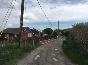
Project 7E - Suburban Connectors*
Connectivity is poor from the suburbs to the north of Scrooby Road and the quality of the existing routes is currently poor. There are established footpaths and desire lines that connect Hill Top Court with Beverley Road and Saxon Way. These paths have little or no natural surveillance, are poorly surfaced and lit and unsuitable for all users at all times of the day and year. Improvements are required including:
- Identifying existing and potential routes connecting the suburbs to the north and Town Centre
- Improvements to the existing routes including surfaces, cycle paths and lighting
- Identifying possible improvements to the wider environmental quality including public open space, habitats, and ecology
- Development opportunities to provide more natural surveillance
Funding: s106 / CIL from development opportunities, funding for cycle lanes
Action Points:
- Route identification through consultation exploring patterns of movement, barriers, and safety concerns
- Costed investment plan to improve connectivity
- Explore synergies with green infrastructure / local nature reserve improvement
Identify development opportunities *These projects are outside the Masterplan area but are important enabling works
Image: Footpath and cycleway improvements

Project 7F - Electric Vehicle Charging
There is a desire for more electric vehicle charging points in Harworth and Bircotes. These could be accommodated in new developments, installed in existing car parks, or increased numbers at supermarkets.
Funding: Deliverable as public good in planning and development briefs, engagement with supermarkets and anchor institutions, private investment.
Action Points:
- Engage with local supermarkets to increase the number of charging points
- Explore the feasibility of installation on existing public car parks
- Integrate EV charging into new development
Image: Pedestrian and cycle route in need of investment
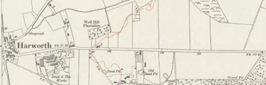
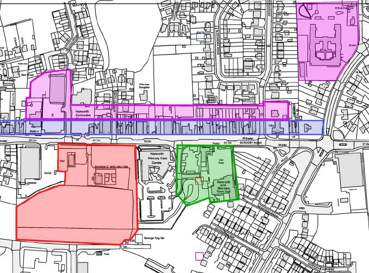
Key Sites and Land Use
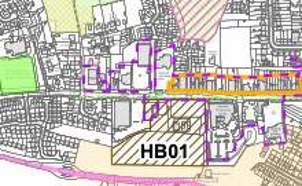
There are several underused sites close to the Town Centre that could accommodate development in the future, increasing the density of uses, maximising the efficient use of land and space and increasing vibrancy and usage throughout the day. These sites are in a variety of ownerships and include some significant public land holdings. Of these the Opportunity Site (HB01) represents a key opportunity to rebalance the Town Centre and increase footfall to the west. There is a desire for increased leisure uses in Harworth and Bircotes and a planning and development brief is proposed that prioritises these uses alongside providing a framework to deliver high quality design and public goods.
The former North Borders School has been identified as a site for older people’s housing with great access to the Town Centre and the remainder of the site could support further development and the provision of ancillary social facilities.
Along Scrooby Road there are some vacant units that could support a variety of town centre uses. There is a desire to increase the variety and choice of the retail offer and an interest in exploring the possibility of a community operated unit in the town centre with an emphasis on local food, crafts, and wellbeing.
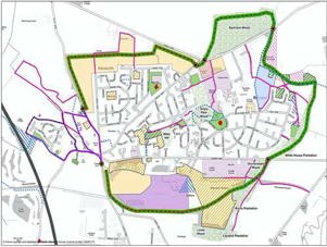
Image: Map of opportunity sites in the Town Centre

Project 8A - Opportunity Site Planning and Development Brief
The planning and development brief will establish:
- Opportunities and constraints
- Key frontages
- Building heights and scale
- The mix of uses
- Connectivity
- Public goods (such as landscape, play, public art)
- Parking and EV charging
- Renewable and low carbon energy
- Medium to large scale battery storage as feasible
- Relocation strategy for existing users as required
The planning and development brief will be in the form of a prospectus to accompany land disposal and development agreements in the future. The brief will be developed in consultation with the community and stakeholders.
Funding: Grant assistance will be sought from the SYMCA to support the necessary technical reports to support the development of brief.
Project 8B - Community Shopfront
The establishment of a community hub on Scrooby Road in a vacant unit to comprise the following potential uses:
Pop-up and experimental retail
- Kitchen and teaching space
- Local produce and allotment surplus sales
- Food bank and information point
- Social crafts space
- Exhibition and collaboration space
- The operating model is to be decided.
Funding: Initial seed funding will be required for a head lease or acquisition to be secured
Action Points:
- Identify suitable unit(s) on Scrooby Road
- Develop and business plan and operating model
- Secure seed financing
- Acquire or lease unit
Project 8C - North Border School Planning and Development Brief
The planning and development brief will establish:
- Opportunities and constraints (inc. heritage considerations)
- Key frontages
- Building heights and scale
- The mix of uses
- Connectivity
- Public goods (such as landscape, play, public art)
- Parking and EV charging
- Renewable and low carbon energy
The planning and development brief will inform the next stages of development, managing and providing clarity on a full range of issues.
Funding: Grant assistance will be sought from the SYMCA to support the necessary technical reports to support the development of brief.
Project 8D - Vacant and Underused Land Survey
Through the masterplan consultation individual landowners and operators of key sites will be directly contacted regarding opportunity sites close to the Town Centre. Potential uses might include:
- Housing, providing variety and choice for a wide range of groups including younger and older people
- Space for outdoor eating and drinking
- Extensions to current retail and leisure activities
- Local food growing and meantime use
Funding: The consultation phase is included in the current masterplan.
Action Points:
- Consultation with businesses and owners around the Town Centre
- Highlight opportunities for development and signposting to potential sources of assistance including design and implementation
Image: Former North Borders School
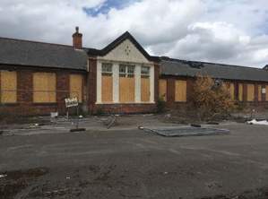
Image: Underused land close in the Town Centre
Design and Appearance
Harworth and Bircotes has an identifiable character that should form the basis for future development to retain a sense of place, balanced with a bold vision for the future. The key characteristics that have been identified include:
- Early twentieth century art deco buildings
- ‘Corner turning” buildings at key junctions
- Some high-quality traditional shopfronts
- Generally single storey public buildings, with two storey shops on the main street
- Subtle hierarchies in building scale and height
- The beginnings of a ‘yard’ structure perpendicular to Scrooby Road
- A predominance of informal greenspace giving sense of connection to nature
Detractive features include:
- Some poor quality and poorly maintained shopfronts
- Steel shutters that remain closed through the day
- Untidy plots and fly tipping
- Unmanaged greenspace
- Buildings set back from the pavement without a suitable boundary or positive use for forecourts
- A dominance of car parking (in some locations) leading to a loss of street continuity and enclosure
- Poor quality and underused upper floors
The occasionally ‘run-down’ feel of some buildings is offset by a great aspect and some well cared for buildings, shopfronts and retail displays that add interest to the street scene. Measures to improve the existing buildings could include:
- Shopfront improvements
- Guidance for pavement cafés and the use of forecourts (see 7B – Bringing the Life to the High Street)
- Retrofitting and the refurbishments of upper floors to provide additional business space and provide decent housing including energy efficiency
- Green walls to improve unsympathetic buildings
- Street retrofit to include sustainable drainage, trees and habitats
To guide future development a high-level design code is included in this Masterplan to provide a starting point for new developments and the regeneration of existing sites.
Image: Character Buildings - Scrooby Road
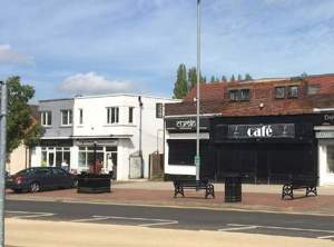
Image: Natural areas close to the Town Centre - new development should mitigate for any loss of habitat
The Design Code should be used to define the character and function of new developments within Harworth and Bircotes Town Centre. It will also provide a starting point for any future design code work that a Neighbourhood Plan review may wish to consider.
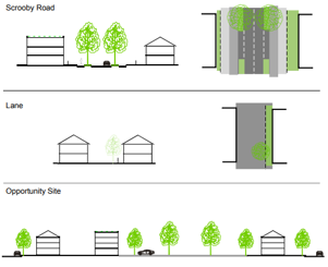
Design Code
Layout
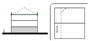
Scrooby Road North (Frontage)
- 3 storey maximum (2 storey minimum) noting floor to
ceiling heights of adjoining buildings - The full width of the plot must be built out.
- Set-backs are limited to 3 m with a suitable boundary and forecourt treatment (no forecourt parking)
- Roofs less than 30% pitch must be green.
- Corner features encouraged on main junctions
- Ground floors must be flexible to allow for commercial uses now and in the future.
- Parking may be accommodated to the rear
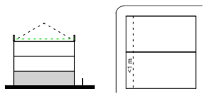
Scrooby Road South (Frontage)
- 3 storey maximum (2 storey minimum)
- The main frontage must connect to the street and active frontages provided to any existing or created public space
- Set-backs are limited to 1 m with a suitable boundary (except civic and community uses).
- Roofs less than 30% pitch must be green.
- Car parking is to be accommodated to the rear
- Ground floors must be flexible to allow for commercial uses now and in the future
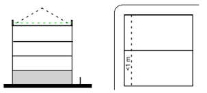
Opportunity Site (Frontage and Rear Plots)
- 4 storey maximum (2 storey minimum) subject to shading and overlooking
- The full width of the plot may be built out
- Set-backs are limited to 1 m with a suitable boundary.
- Roofs less than 30% pitch must be green.
- Car Parking is to be accommodated to the rear of the frontage
- Ground floors must be flexible to allow for commercial uses now and in the future
- 3 storey maximum (subject to amenity and overlooking)
- The full width of the plot may be built out
- Set-backs are to be greater than 1 m with a suitable boundary
- Roofs less than 30% pitch must be green.
- Car Parking is to be accommodated off site or on plot to the rear
- Active frontages must be aligned to new or existing public spaces
In all cases residential units must have outdoor spaces (balconies or gardens)
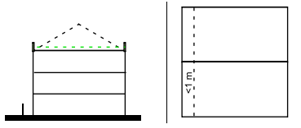
Public Realm
Image: Illustration of Scrooby Road, the Lane and the Opportunity Site
Materials
Image: Examples of brick, living wall, render, a living roof, a roof garden, slate, pantiles, setts, meadows, bonded gravel and bioswale

- Wall - Brick, living wall and render
- Roof - Living roof, roof garden, slate and pantiles
- Ground - Setts, Meadows, Bonded Gravel and Bioswale
Sustainability
Images: solar panels on a roof, an allotment, a bike shed and water management system.

- Energy - Buildings should be designed to minimise energy consumption and integrate renewable energy
- Local Food - Local food growing opportunities should be integrated into new developments and the existing streets and spaces nearby
- Active Travel - Integrate secure cycle parking for residents and visitors
- Water Management - Use water management as an opportunity for habitat creation and creating attractive and playful spaces
Conclusion and Next Steps
This is the Consultation Draft of the Harworth and Bircotes Masterplan. It has been produced after an initial public engagement process in September 2021 and represents the current ideas and projects to the delivery the vision of a vibrant, inclusive and sustainable Town Centre.
Your views are very important, please let us know your thoughts and have your say.
Appendix 1: Opportunity Site Planning and Development Brief
Introduction
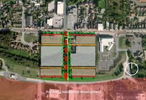
This Planning and Development Brief is for the site identified the emerging Bassetlaw Local Plan 2020-2038 as an extension to the Town Centre of Harworth and Bircotes. The site has a number of complex constraints but offers an opportunity to consolidate the offer of the Town Centre through the regeneration of the site that makes up a significant part of the southern side of Scrooby Road. Complementing and connecting to the adjoining residential development and regeneration of the former Colliery the Opportunity Site is intended to be a step-change in the offer and quality of Harworth and Bircotes Town Centre.
This Planning and Development Brief should be read in conjunction with the emerging Bassetlaw Local Plan and the Consultation Draft of the Harworth and Bircotes Town Centre Masterplan.
The Purpose of this Document
This Planning and Development Brief is intended to guide the development of the site known as the Opportunity Site. Any proposed scheme should be designed in accordance with this brief and the various public goods delivered on site. This brief identifies the key opportunities and constraints relating to the site and range of uses that could be accommodated, alongside the key design principles to guide the future development of the site and provide certainty to the local community and stakeholders.
Site Description
The opportunity site is adjacent to the south side of Scrooby Road within Harworth and Bircotes Town Centre. Part of the site is identified in the emerging Local Plan as HB001, in addition is an area of land that extends as far as Brinsley Way to the south. The site is currently a mixture of existing uses, infrastructure, woodland, and hard standing. The site is currently dominated to the south by the presence of the spoil heap as a legacy of the colliery operations that ceased in 2016.
Bounded to the north by a former hedgerow and trees the site has an adjoining pavement providing access to the Aldi store to the west. To the east the Primary Care Centre bounds the site in a slightly elevated position.
Image: Opportunity Site from Scrooby Road
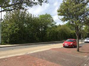
Bounded to the north by a former hedgerow and trees the site has an adjoining pavement providing access to the Aldi store to the west. To the east the Primary Care Centre bounds the site in a slightly elevated position. This Brief, in addition to the area identified in the Local Plan as HB001 extends as far as Brinsley Way to the south.
Image: Extract of the Local Plan
Opportunities and Constraints
The site benefits from direct access from Scrooby Road, the main thoroughfare through Harworth and Bircotes Town Centre, with good visibility there are opportunities to create a new junction to serve a variety of uses and their servicing needs. The site is in a very sustainable location.
The site accommodates an 11KV electricity substation connected to the grid via overhead lines and underground infrastructure onwards to local distribution. It is not planned to relocate this substation, which requires access for servicing, maintenance, and emergencies.
To the south of the site area there is a substantial spoil heap. It is understood that within this heap there are underground cables, although this has not been confirmed. Elsewhere in Harworth and Bircotes heaps have been removed to facilitate development and it is assumed that this is feasible – leading to unconstrained level site in the future.
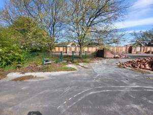
There is an existing building on site which is currently occupied by a Scout Group. This building is not to be retained, although the current users will need to be relocated.
Ground Conditions and Services
There are multiple wayleaves across the site including high voltage cables both overhead and underground. In addition the site is dominated by a large spoil heap dating from the mining activities of the twentieth century. Remediation and removal has taken place elsewhere in Harworth and it is considered feasible to remove this feature to create a level site with access and connectivity to Simpson Park.
Site Analysis
Previous studies have identified a feasible access point from Scrooby Road allowing for the cable easement from the substation to the north of the site. The site has potential access from the south from Brinsley Way. To the south there is the residential area of Simpson Park and a further piece of land in the ownership of the developer, the Harworth Group, lies between the site and the existing housing.
The existing woodland is situated on the spoil heap to the south of the site and appears to be partially planted and partially a result of natural succession. The removal of the spoil heap would result in the loss of this green infrastructure.
Image: Map displaying the locations of - existing boundary, feasible vehicular access, existing building, existing woodland, additional development opportunity and cable easements (approximate)

There is an existing building on site that can be removed as part of any proposed development. The substation is assumed to be retained in any development proposal, there are associated overhead lines that will have an impact on construction. Connecting the site to the north are two cable easements that cannot be built over, to the west the easement relates to the overhead lines.
Uses
The range of uses envisaged for the site in the Local Plan is a small-scale extension to Harworth & Bircotes town centre to include up to 500sqm of comparison goods floorspace, other main town centre uses, and associated infrastructure including an appropriate financial contribution towards the provision of a pedestrian crossing on Scrooby Road. The full range of town centre uses, over and above the limited retail provision could include:
- Residential development providing a range of unit types and tenures
- Leisure such as cinema, soft play, bowling and associated food and beverage units
- Office use, including co-working space
- Civic functions, the third sector and other social infrastructure
- Nursery provision
- The collocation of services such as library, post office and healthcare
A vertical mix of uses is envisaged and development of a scale complementary to a town centre location of over 2 storeys is encouraged. A strong active frontage is required along Scrooby Road that should incorporate main entrances to activate the street.
Access and parking
There are several feasible access points off Scrooby Road, however, co-location with easements is desirable to reduce the infrastructure costs of access and to reduce the undevelopable area on the site. Access may be possible, subject to modelling and consultation from Brinsley Way. As a minimum pedestrian and cycle connectivity must be provided between Scrooby Road and Brinsley Way.
In line with the Design Code, developed as part of the Harworth and Bircotes Town Centre Masterplan parking provision is to be provided within the site and not to form the frontage. Secure and covered cycle storage must be provided for residents, visitors and building users.
Electric Vehicle charging must be provided throughout the site in line with the County Highways guidance and building regulations, and could be exceeded if it can be demonstrated that there is adequate grid capacity in the immediate area.
Energy and Climate Change
The site is an opportunity to create a development that is energy efficient. Nonresidential development must achieve BREEAM Excellent standards and residential development should meet the requirements of the Local Plan and Building Regulations. The orientation and design of the buildings should take into consideration the sun path and prevailing winds alongside passive energy efficiency measures.
The mix of uses envisaged lends itself to the establishment of a centralised heating and cooling network, taking advantage of heat pump technology and the balancing of loads across the site.
There are potentially significant roof areas that could be utilised for solar generation and buildings should be designed to take advantage of this resource.
The proposed landscaping must be designed to adapt to the changing climate through drought resilience, contributing to flood and water management through Sustainable Drainage Systems such as swales and attenuation ponds. Additionally, the potential for green roofs and walls, trees and water bodies to reduce summer temperatures should be harnessed and integrated into the landscape design and site layout.
Design Guidance
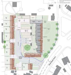
The Council expects the highest standards of design quality. As part of the Harworth and Bircotes Town Centre Masterplan a Design Code has been developed and this should form the basis for development proposals. In addition, the diagram below provides specific guidance on the key frontages, building heights and the location of car parking required to meet these requirements.
Image: Map showing parking, key frontage and secondary frontage
Key Deliverables
The objective of this Brief is to guide the sustainable regeneration of the Opportunity Site. In doing so proposed developments must:
- Provide equitable access for all groups
- Contribute to the creation of a new junction and pedestrian crossing
- Meet the requirement for 10% biodiversity net gain on site
- Provide a climate resilient development
- Secure uses that support the function and viability of the Town Centre
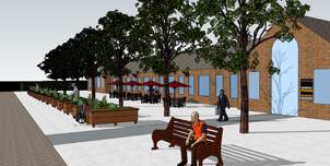
Image: Artist Impression

Appendix 2 - Former North Borders School Planning and Development Brief
Introduction
This site has been derelict for some years and is a key development opportunity. The site comprises two distinct building complexes, of which one has been granted planning permission for older people’s housing. The second phase, focused on the former Infants School building, is the subject of this Planning and Development Brief.
This Planning and Development Brief should be read in conjunction with the emerging Bassetlaw Local Plan and the Consultation Draft of the Harworth and Bircotes Town Centre Masterplan.
The Purpose of This Document
This Planning and Development Brief is intended to guide the Phase II development of the Former North Borders school site. Any proposed scheme should be designed in accordance with this Brief and the various public goods delivered on site. This Brief identifies the key opportunities and constraints relating to the site and range of uses that could be accommodated, alongside the key design principles to guide the future development of the site and provide certainty to the local community and stakeholders.
Site Description
The former North Borders School site has two distinct building complexes, set in grounds that comprise of a combination of hard standing and green areas given over to grass. There are a few associated outbuildings on site also, that are in a poor state of repair. The existing buildings are in a poor condition and have been the subject of vandalism and arson.
The southern range of buildings are the subject of a planning application to create housing for older people which is still pending a decision. The proposed scheme is a combination of retrofit and new build, with amenity space and parking. This proposed scheme provides much needed housing choice and supply in the area, in a sustainable location close to the Town Centre and makes creative use of this historic building.
Opportunities and Constraints
Heritage
The former North Borders School is a non-designated heritage asset and the subject of an Article 4 Direction dating from 2018. The buildings, although subject to damage, vandalism and being unoccupied are good quality architecturally and have a distinctive character that positively contributes to the local area. This Brief relates to the northern range of buildings that were formerly the infant’s school.
Image: Layout of Adjoining Housing Development
The former North Border Junior and Infants School buildings are regarded as non-designated heritage assets, identified in line with the Council’s approved criteria. They conform to the criteria by way of their historic and architectural interest, their aesthetic appeal, association, integrity, rarity and representativeness. They were designed by the early-20th century Nottinghamshire County Council architect Leonard Maggs, who was responsible for a number of inter-war schools through Nottinghamshire, especially in the coal field areas. The non-designated heritage asset database gives the following information:
“Infants and nursery school, built 1920s; designed by L.E. Maggs (chief architect at Nottinghamshire County Council), typical regular symmetrical plan, single storey, red brick (parts rendered), slate roof, stone dressings, brick chimney stacks, original timber windows throughout; site became vacant in 2015 - Article 4(1) Direction made 8th March 2018.”
Image: Existing Former School Building
Amenity
The site is adjoined by several neighbouring residential properties and the proposed uses must ensure that privacy and amenity is not compromised by noise and overlooking. There are robust boundaries adjoining the site and it is not envisaged that these will change, and these could also be reinforced through the development of the site.
Ecology and Trees
There are several trees on site that are associated with the Infants school building that are worthy of retention and that are adding to the character and appearance of the site and providing a habitat. A tree survey was undertaken for the adjoining site planning application which is available separately to this Brief. In summary the immediately adjoining trees are either Category B – worthy of retention or Category C – lower value which would allow some removals to facilitate development opportunities.
Planning Policy
The adopted Local Plan is the Bassetlaw District LDF Core Strategy (2011), however this is slightly dated.
The Local Plan for Bassetlaw has reached an advanced stage with modifications consultation expected in Summer 2023, followed by adoption by the end of 2023. As such, it is appropriate to align the masterplan with the Local Plan. In the Plan, Harworth and Bircotes is identified as a main town. Under Policy ST1 the spatial strategy within the plan is to support the regeneration of the main town centres. The Harworth and Bircotes Town Centre Masterplan is identified as a key document in delivering a sustainable local shopping and service offer that is accessible and safe. The site is in proximity to the Town Centre, which the Plan identifies as having a concentration of uses focussed within the Local Plan boundary. However, as the site in not in the Town Centre there are restrictions on the range of uses that could be proposed for the building.
The Harworth and Bircotes Neighbourhood Plan (2015) does not specifically identify the former North Borders School as a development opportunity. The National Planning Policy Framework (NPPF) and Local Plan provides specific support for the use of previously developed land and redundant buildings and this development opportunity accords with this aim.
Site Analysis
There is existing access from the adjoining Snipe Park Road that could serve the building separately from the residential development to the south. The recently demolished building in the former playground has provided space in front of the building that could perform a range of functions. To the rear there is an area of greenspace that provides a buffer between the existing building and the adjoining existing residential properties to the north, east and west.
To the rear of the main frontage the building has a flat roof extension. There is a further rear element forming part of the original building. The south elevation of the building is a balanced and distinctive composition. In line with the recently undertaken tree survey wherever possible the Category B trees should be retained.
The building is generally orientated east west presenting a roofline to the south with a significant solar potential.
Uses
The existing building lends itself to several possible uses with clear synergies with the adjoining proposed older peoples housing.
Residential
The building could be converted to residential use, with a significant ground floor footprint that could provide accessible accommodation for a variety of groups. Additionally, this could be allied to complementary healthcare and wellbeing uses that could serve the wider community. It may be possible, subject to design, to accommodate further floors above the main elevation to create additional residential floorspace, increasing the viability of the overall scheme. In doing so the main elevation would have to be retained.
Image: Map of Residential Area showing locations for green boundaries, later extension, where to retain trees where possible, building to be demolished, green space, key frontage and the approximate extent of the adjoining residential development

Community and Civil Society
The building could lend itself to community uses, either as part of a mixed-use scheme or exclusively for a non-residential development. As a hub for the voluntary sector, wellbeing, training, and social prescribing an element of office use could be accommodated to support these uses, whilst also potentially being the back office for the Town Council.
Healthcare
Subject to consents and heritage considerations additional floors could be accommodated, and the building could accommodate a range of healthcare uses including step-down care, physiotherapy, clinical space and rehabilitation.
Access and Parking
The site could be accessed from either a dedicated access (illustrated above in the Site Analysis) or from the access related to the residential development proposed in Phase I to the south. On-site parking could be accommodated on the former playground.
The site is in a sustainable location with good access to public transport and the walking and cycling network, new developments must provide adequate covered and secure cycle storage for residents, building users and visitors.
Energy and Climate Change
Heating and Cooling
The building is surrounded by extensive grounds that could be used for a ground sourced heat pump. Alternatively, air sourced heat pumps could be employed as part of a centralised heating and cooling system.
Energy Efficiency
New developments should seek to maximise the energy efficiency of the building. Options may be limited as the building is Listed; however new roofs could accommodate additional insulation. Where the original windows have been lost it may be possible to specify double glazed units. New build elements should seek to exceed the current building regulations by 20% in terms of emission rates and materials with a low embodied carbon should be specified.
Renewable Energy
The building has significant solar potential and subject to the necessary consents could support the use of solar energy through any re-roofing, using solar slates.
Climate Change Adaptation
Proposals should ensure that all opportunities are taken to adapt to climate change, including extreme weather events, increasing summer temperatures and drought conditions. Whilst the building fabric can be designed to reduce cooling loads in the new build elements the use of green infrastructure and SUDS is encouraged to reduce surface water run-off and provide summer cooling.
Key Deliverables
The objective of this Brief is to guide the sustainable re-use of the building and the site.
In doing so proposed developments should:
- Provide equitable access for all groups
- Protect the amenity of surrounding residential properties
- Minimise harm to the significance of the Listed Building and better reveal its character and appearance.
- Exceed the requirement for 10% biodiversity net gain on site
- Provide a climate resilient development
- Secure community uses complementary to the residential uses in the wider site and surrounding area
Design Guidance
The Harworth and Bircotes Town Centre Masterplan includes a design code that covers the Former North Borders School. In summary development proposals are limited to a maximum of three storeys. The frontage of the former school is an important part of the significance of the Listed Building and extensions to the front are unlikely to be supported. Any proposed landscaping should seek to complement the setting of the Listed Buildings, provide solar shading, habitats and support flood and water management. The Council expects high quality design that enhances the appearance and function of the area.
Image: Artist Impression
Feedback
Make a comment on the Harworth and Bircotes Town Centre Masterplan.
Last Updated on Wednesday, July 10, 2024